Our Story
How a family road trip in 2017 became a complete photographic archive of every covered bridge in Oregon.
Chapter 01 — The Beginning
A brochure
changed
everything
It started in the glove compartment. Somewhere between Eugene and the coast we found a faded Oregon Tourism brochure — the kind with small photos and optimistic copy — listing the state's covered bridges as a driving route. Fifty one stops. We had no idea Oregon had that many.
I had just picked up a DJI drone and was looking for an excuse to use it seriously. My wife had been wanting to gain more experince with the camera. Our son was at an age where driving through forests and crawling over riverbanks was still considered fun. The planets aligned.
We planned the first trip for a weekend in January. We figured we'd knock out a few, see if the footage was any good, maybe call it done. Six bridges later we were already mapping the next route.
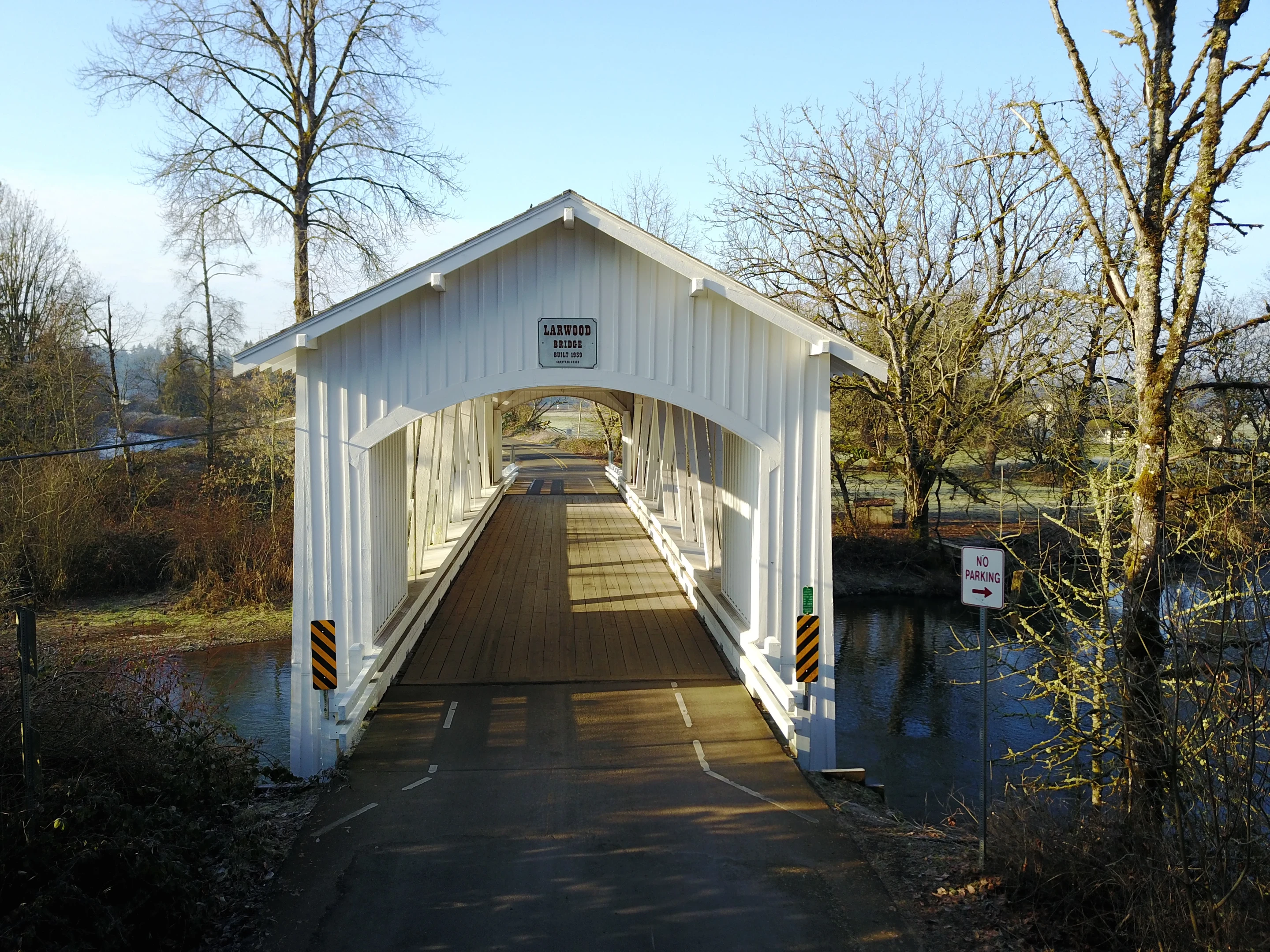
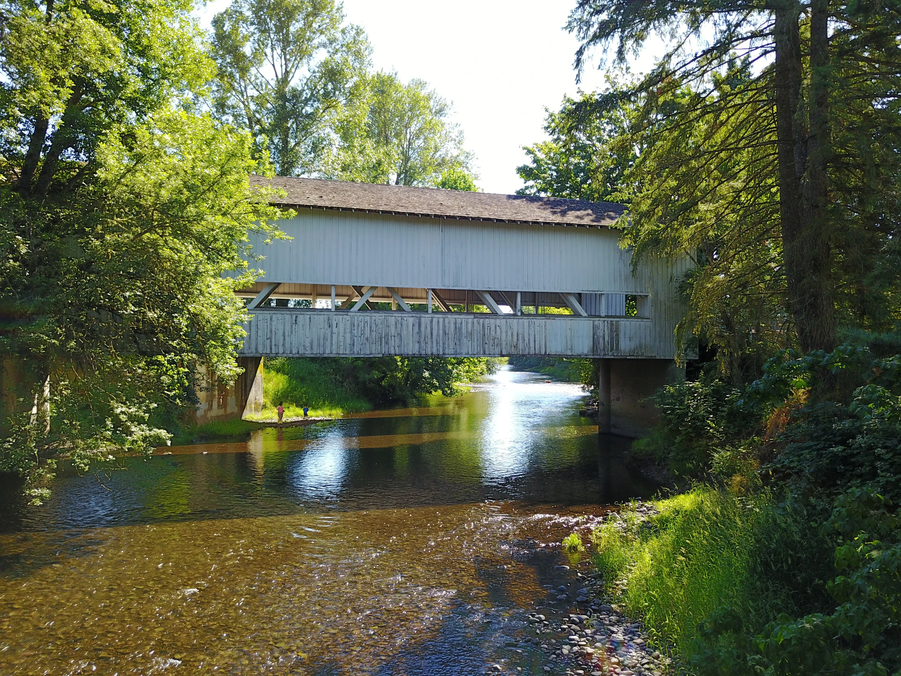
Larwood Bridge — January 16, 2017 · First trip
We found the brochure, looked at each other,
and thought — why not go find them all?
Chapter 02 — Two Lenses
Drone up high.
Camera at the water.
Neither of us are photographers. We're just two people who wanted to document something before it disappeared — the trips, the bridges, the particular way a summer afternoon looks when you're standing on a plank floor over a creek in the middle of nowhere. The gear was a means to that end. What surprised us was how much the two perspectives — aerial and ground level — ended up complementing each other.
The Drone
The DJI revealed what you can't see from the road — how the bridges nestle into creek valleys, how the timber rooflines catch morning light, how small they look against the surrounding forest. Most of the aerial shots were taken within the first ten minutes at each stop to get the lay of the land.
The DSLR
While the drone covered the sky, the DSLR stayed on the ground — shooting portals, interiors, the detail of hand-cut timber joints, the creeks running under plank floors. The two perspectives together tell a more complete story than either could alone.
Chapter 03 — The Journey
Six trips,
eight months
March 12 & 19, 2017
Coast & Valley
Oregon Coast · Willamette Valley
Rain most of the day. The coastal bridges have a different character — darker timber, mossy, more solitary.
May 6–27, 2017
Southern Lane County
Willamette Valley · Oregon Coast · Portland Metro
The most productive month — three separate days across Lane, Lincoln, and Multnomah counties. Lane County alone holds more covered bridges than most states.
June 10 & 25, 2017
Into the Valleys
Willamette Valley
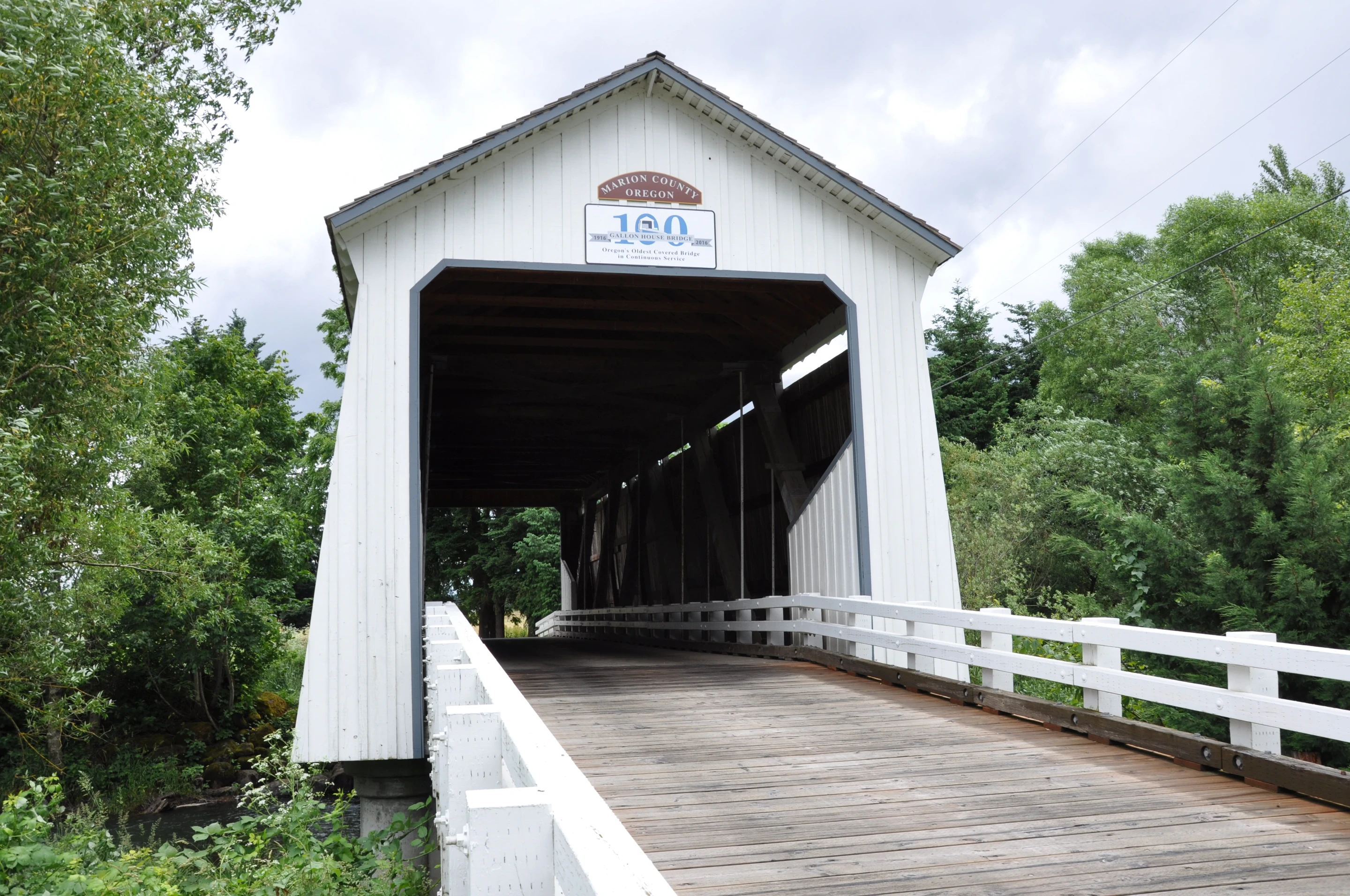
Gallon House stopped us cold. The light inside the portal, the creek below — we spent an hour just walking around it.
July 2–29, 2017
The Big Push
Willamette Valley · Southern Oregon · Oregon Coast · Central Oregon
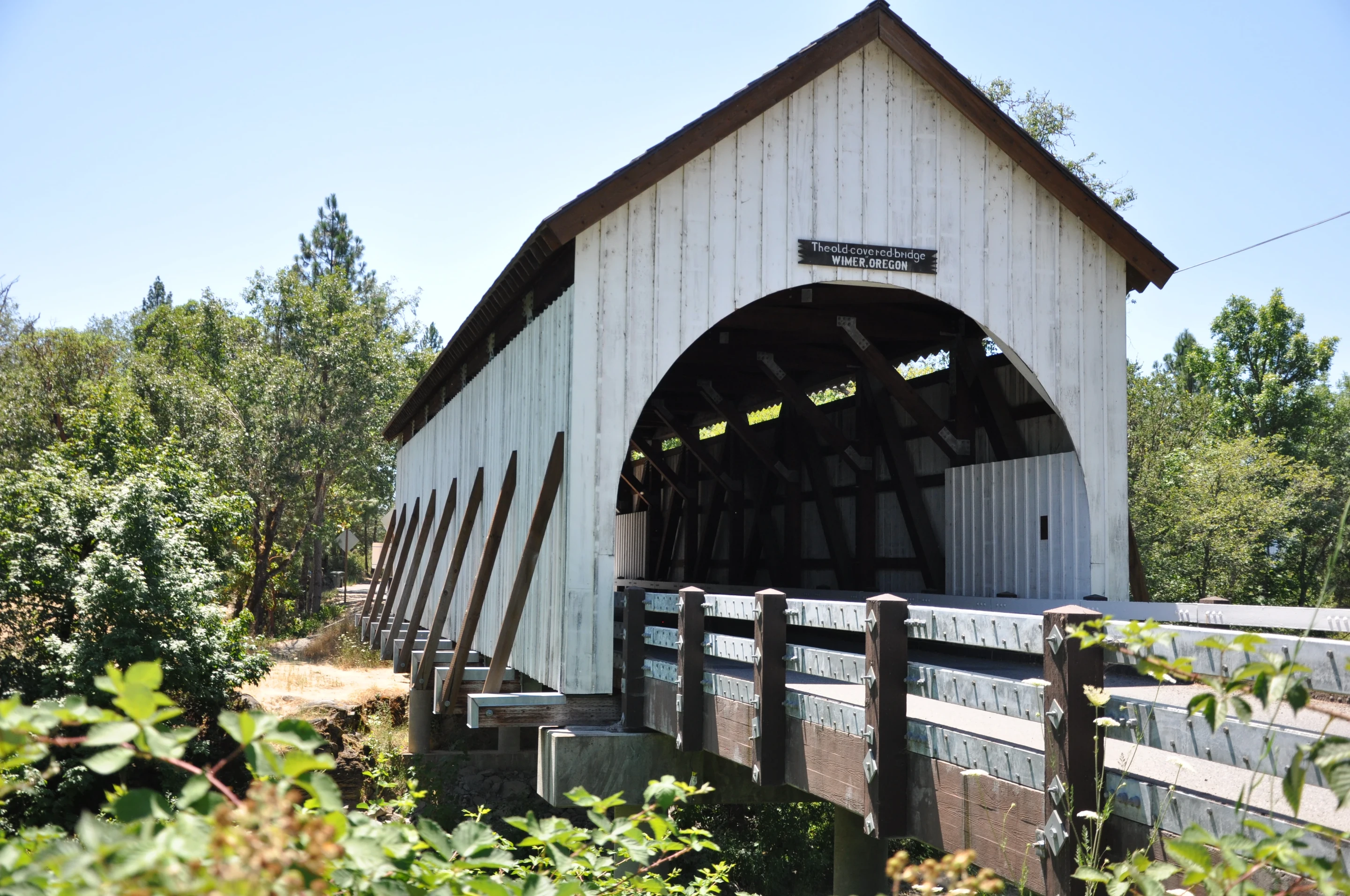
Five separate days across the month — south into the Applegate Valley, east to Deschutes County, and back up through the McKenzie corridor. McKee Bridge was a highlight.
August 8–10, 2017
The Final Stretch
Southern Oregon · Willamette Valley
Three days to close out the project. Irish Bend was the last — a quiet Benton County bridge over the Long Tom River. A fitting end.
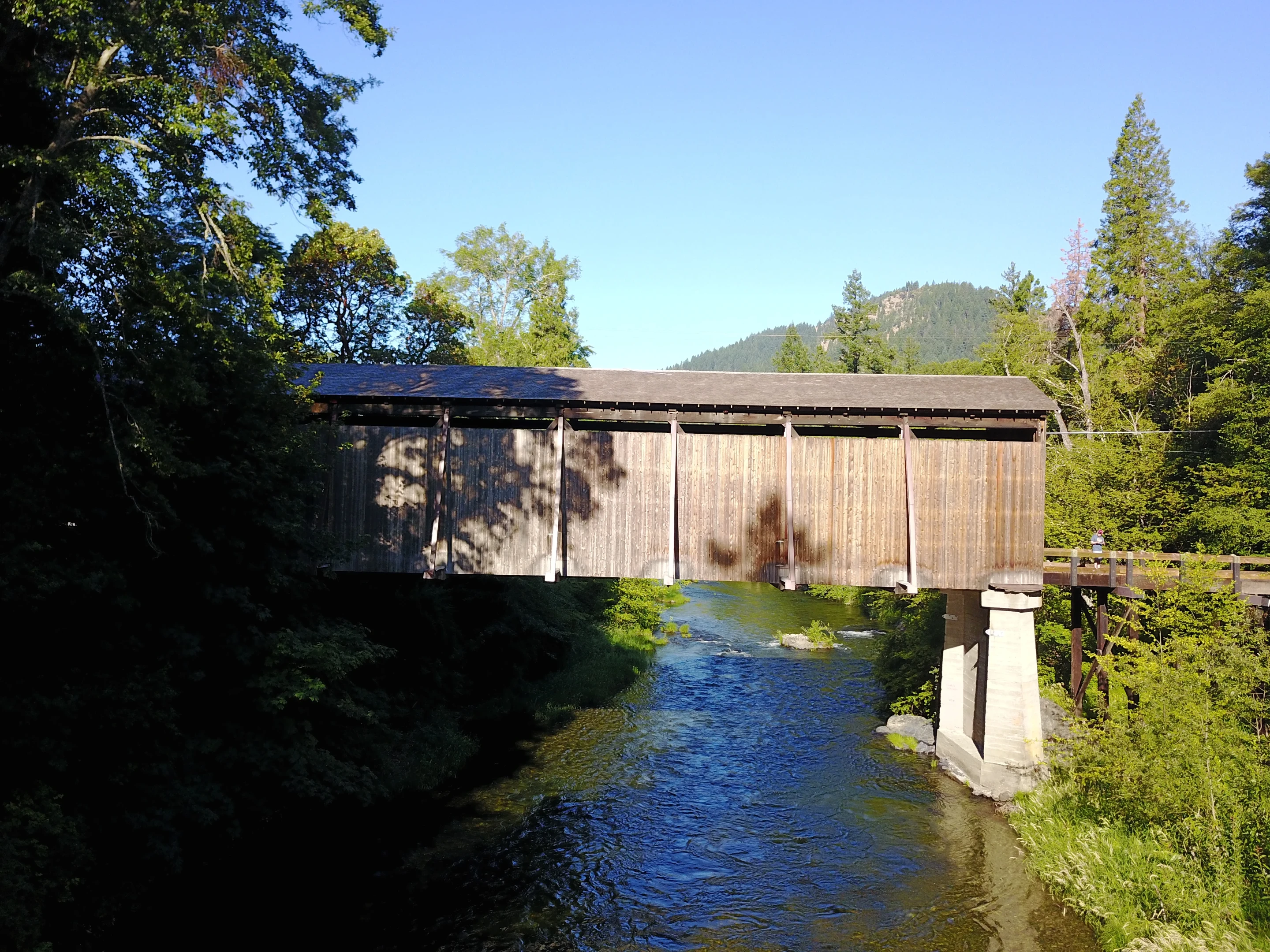
McKee Bridge, Jackson County — July 9, 2017
Chapter 04 — On the Road
Riverbeds,
ranch roads,
and lunch stops
The logistics were less romantic than the photos suggest. Long drives on unmarked forest roads. Bridges tucked a mile past the last cell signal. A son who had firm opinions about when the day should involve food.
But that friction was part of it. You can't really understand these bridges from a photograph — you have to feel how isolated some of them are, how quiet the creek sounds through the plank floor, how the light shifts inside the dark timber frame as clouds move overhead.
We made a rule early on: no chains, no franchises. Every lunch had to be somewhere local. It turned out to be one of the best decisions of the whole project. Small town food worth stopping for. The bridges gave us the route — the local spots gave us the fuel to keep going.
Every bridge.
Every county.
All of Oregon.
Browse the complete archive — photographs, history, and GPS coordinates for all 51 covered bridges in Oregon.